Why use Trellows Estate Agents to

Buy in Cyprus?

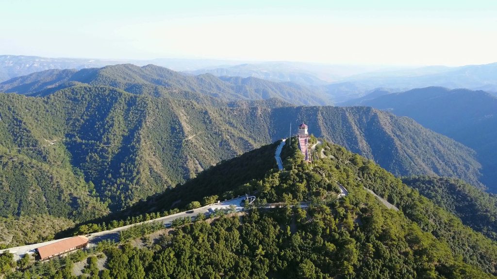
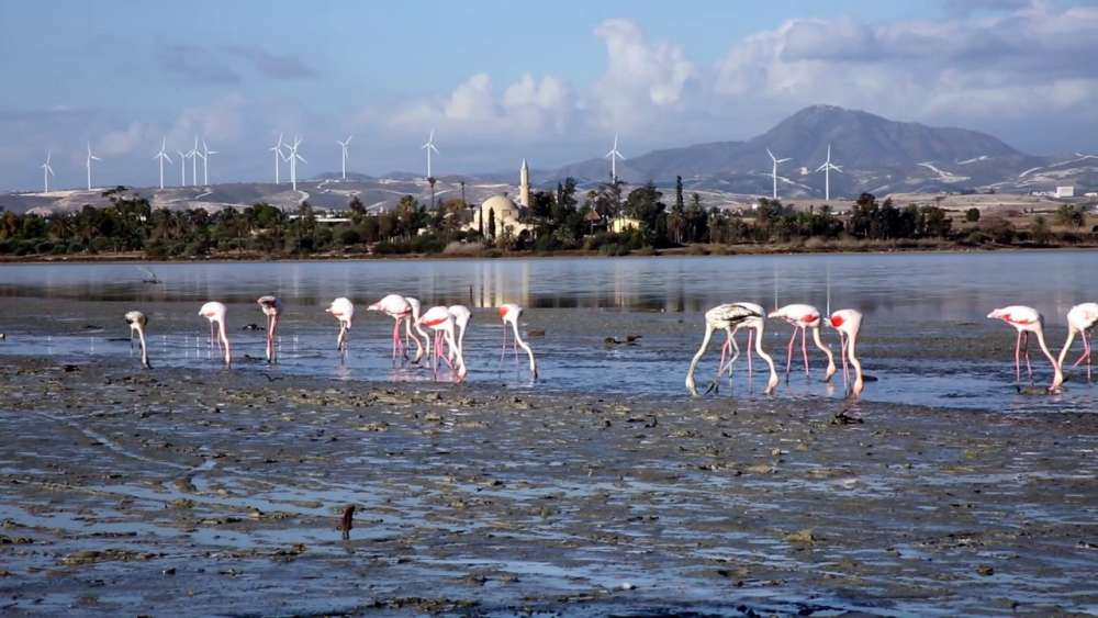
Blessed with the beauty of nature’s best palette, the scenery of Cyprus unfolds across glittering coasts, rolling mountains, fragrant forests and rugged headlands. From the warm shores of the mainland to the unspoiled and cool oasis of the Troodos mountain range, nature lovers, artists, photographers and explorers will all delight in meeting shy creatures, and discovering rare plants that peep out amidst waterfalls, coves, woodland, winding trails and secluded sandy beaches. As the island is on the migration path between Europe, Asia and Africa, Cyprus is a birdwatchers dream, with flocks of flamingos frequenting the salt lakes, and many other significant species passing through or nesting. And deep in the forests, the national animal – the Mouflon – roams freely, with catching a glimpse of this timid, wild sheep a real treat for locals and visitors alike.

Exotic and rare forms of wildlife also give Cyprus a special touch. Green and Loggerhead turtles breed on the island’s sandy beaches in summer, while the Mediterranean Seal and dolphins have also been seen swimming in the warm, calm, crystal clear seas of the island.

Botanists and herbalists will equally appreciate the island’s green side, with a large number of local herbs and endemic plants, including the Cyprus orchid, tulip and crocus waiting to be stumbled upon along winding nature trails and paths less travelled.

From stunning sunrise to breathtaking sunset, the natural allure of Cyprus is both magnificent and inspiring… and all waiting to be uncovered.

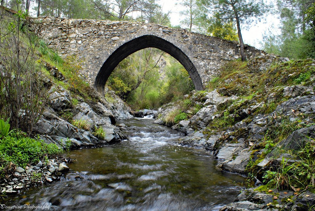
Elia-bridge-1024x686

Venetian Bridges

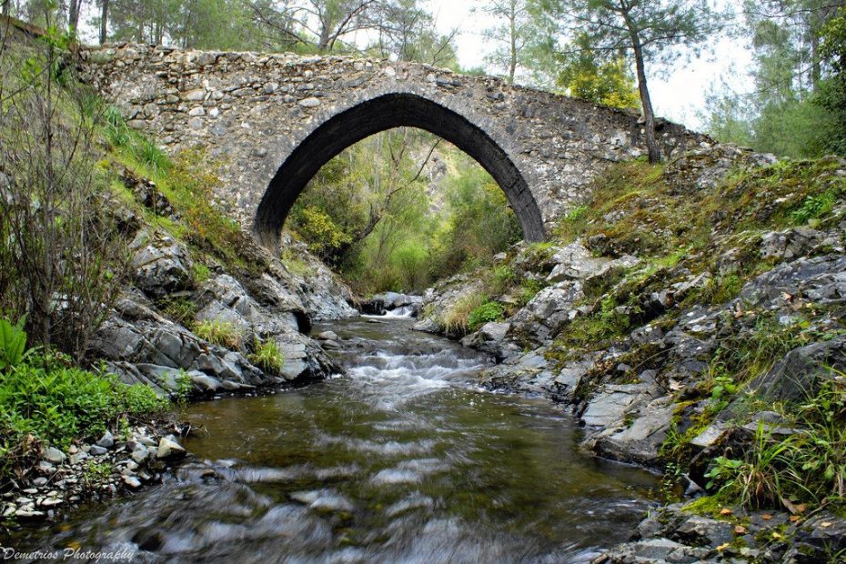
One of several bridges that were constructed by the Venetians to transport supplies to their ships.

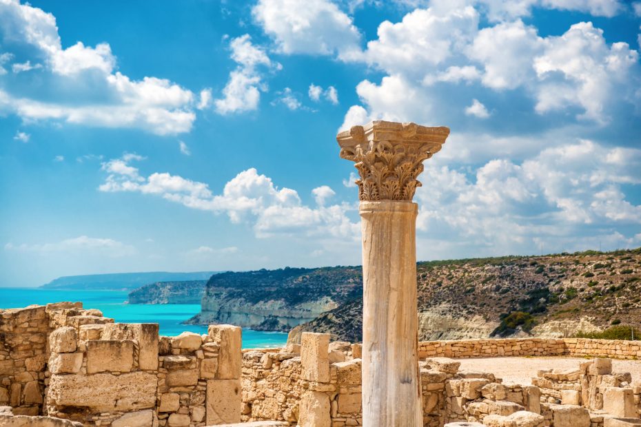
?uins of ancient Kourion. Limassol District. Cyprus.

Ancient Kourion

The archaeological remains of Kourion

Troodos Botanic Garden

Troodos Botanic Garden is comprised of an extensive Botanic Garden

cedar-valley

Cedar Valley

The breathtaking mountain locality of Cedar Valley is nestled within Pafos Forest

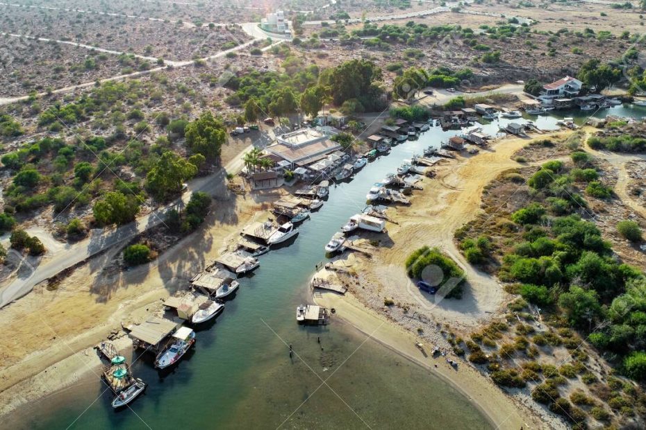
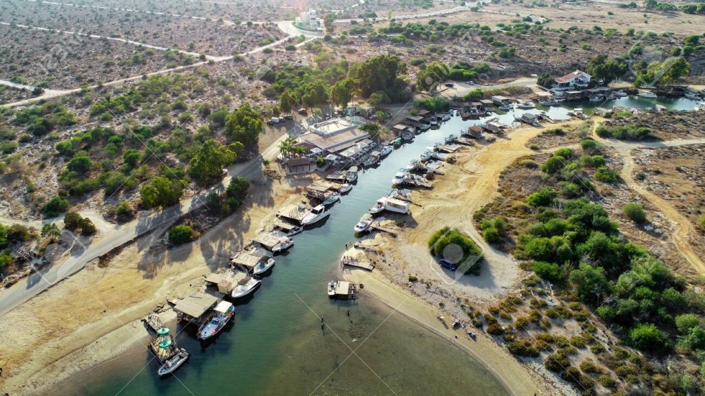
Aerial bird's eye view of Liopetri river to the sea (potamos Liopetriou), Famagusta, Cyprus. A landmark tourist attraction fishing village, natural fjord with colourful boats moored on the banks at Kokkinochoria, Ammochostos, from above.

Potamos Liopetri

Located just past the western edge of Ayia Napa is Potamos Liopetri, or Liopetri River.

maxresdefault (1)

Athalassa Park

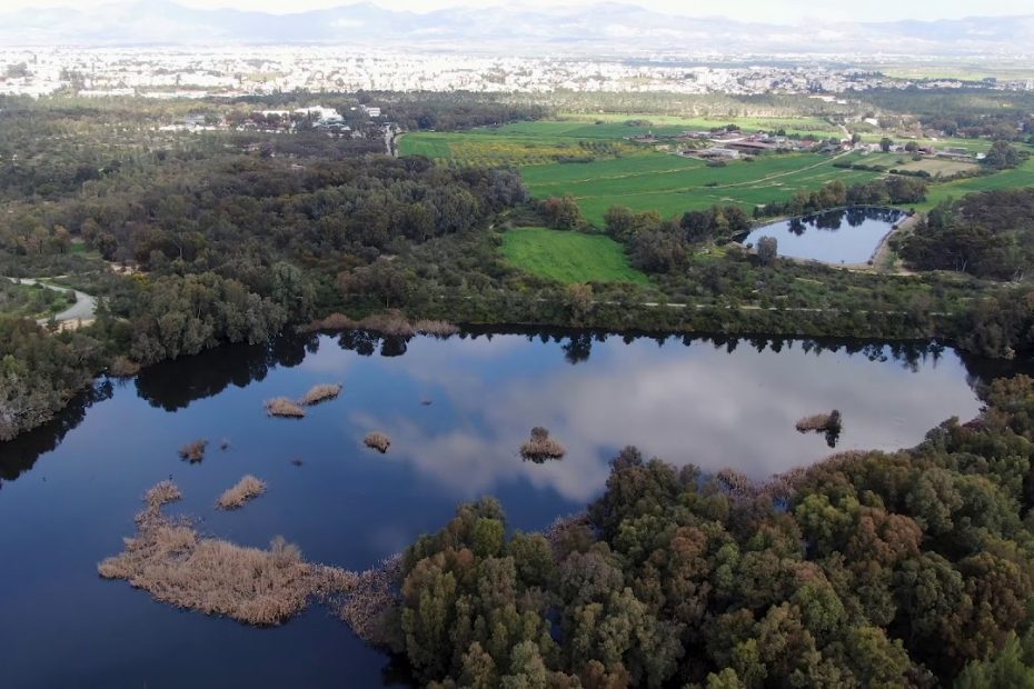
Athalassa National Forest Park is an oasis of greenery set across an area of 840 hectares

Mitsero Red Lake

The water of the lake had been colored red by the minerals and its high acidity.

EbMYWWTNVfirYek7ZCbJSzoCrGZ1JMvY1CsfVzmV

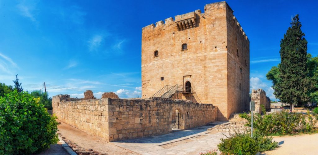
Kolossi Castle

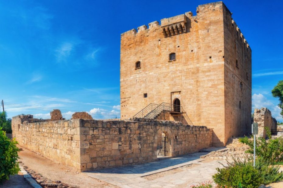
This 700-year-old Cyprus castle is the birthplace of the world's oldest wine

cyprus-greater-flamingos

Larnaca Salt Lake

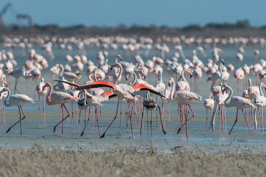
Larnaka Salt Lake is the second largest salt-lake in Cyprus and measures 2.2 square kilometres.

Located south west of Lemesos (Limassol), Akrotiri Salt Lake is the largest inland body of water on the island, and is considered to be one of the most important wetlands in the eastern Mediterranean.

The 10.65 square kmlake fills with water during the winter period, and is home to migrating birds between November and March. These include flocks of thousands of flamingos (Phoenicopterus roseus), cranes, birds of prey and migrant waders – for whom the depth of 30cm across over half the lake provides a welcome stopover. At its deepest point, the lake is around 1m, and at its lowest it is 2.7m below sea level.

The most basic element of the food chain in the lake’s ecosystem is the small fairy shrimp (Branchinella spinosa), which the other life greatly relies on. When flamingos and other water birds are unable to find the shrimp, they desert the salt lake and continue their journey by travelling to Larnaka Salt Lake or south, towards Africa.

Less saline than Larnaka (Larnaca) Salt Lake, Akrotiri Salt Lake is a significant natural habitat fringed with reed beds. It usually dries up in the summer, but not always, andgeologists hypothesize the lake was formed after an offshore islet was gradually joined to the mainland.

Located on the south-eastern edge of the city of Lefkosia (Nicosia), Athalassa National Forest Park is an oasis of greenery set across an area of 840 hectares, with many endemic, indigenous and adventive trees, shrubs and herbs. Its network of trails – covering 20 kilometres – makes it a popular place for cycling, walking and dog walking (on a designated pathway).

The Botanical Gardens are open daily and are free of charge to visit, whilst the grounds of the park also incorporate a Visitor’s Centre that provides information about the environmental features of the park. A scale model replica of the park shows its basic natural features, vegetation and recreational facilities, whilst dioramas give three-dimensional representations of the area’s vegetation, birds, mammals and reptiles.

Geological samples, fossils and related objects are exhibited in a separate room, and visual material is used to present the local fauna and flora.

Region:Lefkosia
Address:Leoforos Keryneias, 1, Aglantzia
Contact No:Visitor Centre, Tel: +357 22 462 943 / +357 22 403 704 / +357 22 805 533
Operating Hours:Monday – Friday: 07:30 – 15:30
Closed on weekends.
Operating Period:Visitor Centre:
All year round.
Closed on Public Holidays.
Entrance Fee:Visitor Centre: Adults / children over 6, €1,00 / Children under 6, free.
Website:www.moa.gov.cy
 Opening and closing times as well as entrance fees, are subject to alterations without notice. Visitors are advised to check before visiting.
 

Located east of Agia Napa and southeast of Protaras, the beautiful and protected National Forest Park and conservation area of Cape Gkreko is a Natura 2000 site that unfolds across 385 hectares of stunning, unspoiled natural landscape.

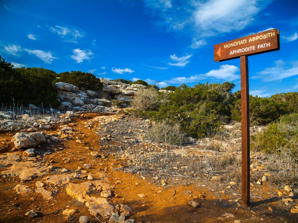
The park incorporates a network of nature trails – lined with Calabrian pine trees and Phoenician junipers – as well as specialist cycling paths, with benches along the way. The two kilometres Aphrodite Nature Trail runs through the southeast coast of the Cape Gkreko promontory, and is part of the Aphrodite Cultural Route that commemorates the island’s link with the Ancient Greek Goddess.

Rich in indigenous fauna and flora, approximately 400 different plant species grow in Cape Gkreko. Out of these, 14 are endemic, and another 14 are extremely rare.

The forest was once abundant with trees, but is now covered with low vegetation, making it home to many mammals, such as foxes, hares and hedgehogs; reptiles such as snakes and lizards, and a large number of birds. The majority of birds are migratory, with five varieties and two endemic species – one of which is  the Cyprus wheatear ‘Oenanthe cypriaca’, a migrating bird that breeds on the island.

The general views from the limestone sea cliffs are spectacular and overlook the crystal clear waters of the region. The area is also highly popular for diving and boat trips to the many caves, where an underwater world awaits discovery.

The tiny, whitewashed church of Agioi Anargyroi is also a lovely place to visit, with steps that lead down to a cave by the sea.

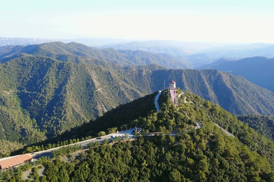
Located on the crossroads of Lefkosia (Nicosia), Pafos (Paphos) and Lemesos (Limassol), the breathtaking mountain locality of Cedar Valley is nestled within Pafos Forest, and is distinctive for its thousands of endemic Cedrus brevifolia species (Cedar trees), which is a close relative of the famous cedars of Lebanon. There are also some Calabrian pines – Pinus brutia in the valley, which is popular for its peaceful seclusion.

The area is crossed by the country road that joins the village of Panagia with the monastery of Panagia tou Kykkou, and also unfolds into Stavros tis Psokas, an additional mountain locality that is home to the rare and shy Mouflon (Ovis gmelini ophion) – an endemic species of wild sheep found exclusively on the island.

The remnants of three old, Venetian mountain bridges are interesting sights to take in whilst enjoying a stroll around the area.

The Environmental Information and Education Centre at Cape Gkreko is one of the first buildings on the island designed to take into account its environmental surroundings, and opened in 2017 to showcase the natural wealth of the Cape.

The Cape Gkreko Environmental Centre is one of the first buildings on the island designed to take into account its environmental surroundings, and opened in 2015 to showcase the natural wealth of the Cape Gkreko National Forest Park, as well as educate on the threats to the area’s ecosystem and its preservation efforts.

The eco-friendly building incorporates a Welcome Centre, souvenir shop, exhibition rooms (with visual and audio guides explaining the different ecosystems of the coastal area and the sea), three aquariums (where visitors can view the marine ecosystems up close), and a café.

Located east of Agia Napa and south east of Protaras, the National Forest Park and conservation area of Cape Gkreko is an area of stunning, unspoiled natural beauty that covers 385 hectares.

The park incorporates a network of nature trails and specialist cycling paths, and is popular for diving and boat trips. It is rich in indigenous and endemic flora and fauna and offers spectacular views from its limestone sea cliffs.

Region:Famagusta (Ammochostos)
Address:Cape Gkreko
Contact No:Tel.: +357 23 814 412
Operating Hours:Monday – Friday: 10:00 – 15:00
Closed on weekends.
Operating Period:All year round.
Closed on Public Holidays.
Entrance Fee:Adults: €2,00
6-12 years old: €1,00
0-6 years old: Free
 Opening and closing times as well as entrance fees, are subject to alterations without notice. Visitors are advised to check before visiting.

Larnaka (Larnaca) Salt Lake is the second largest salt-lake in Cyprus and measures 2,2 square kilometres. In 1997 it was declared a protected area under Cypriot Law for the Prote­ction and Management of Nature and Wildlife and under the European Ha­bitats Directive. It is a significant Ramsar and Natura 2000 site – one of the most significant biotopes in Europe – and one of the most important habitats in Europe for waterfowl.  

Located southwest of Larnaka town and east of the villages of Meneou and Dromolaxia, the Salt Lake – known locally as ‘Alyki’ – is actually one of four lakes in Larnaka. Together, with Lake Orphani, Lake Soros and Airport Lake, the lakes collectively cover a total area of 1.761 hectares.

During the winter, the lake fills with water and is home to migrating birds, including thousands of flamingos that stay between November and March, along with wild ducks and other water or shore fowl that find refuge here on their migratory journeys. The most basic element of the food chain in the lakes’ ecosystem is the small brine shrimp Artemia (Artemia salina), which the other life greatly relies on. When flamingos and other water birds are unable to find the shrimp, they desert the salt lakes and continue their journey by travelling to Lake Akrotiri in Lemesos or south towards Africa.

Winding through the lake area is a designated, linear nature trail that is 4 km in length, and leads all the way up to the old aqueduct of Kamares. The various flora of trees, shrubs and flowers is signposted with information along the way, and there are also periodic benches, making the path popular for walkers and joggers.

Archaeological finds show that the salt lake area and that of the nearby mosque have been inhabited since the Late Bronze Age (2nd century BC). In prehistoric times the salt lake was a harbour that served the town, unearthed near where the Hala Sultan Tekkesi mosque stands today. The town was one of the large urban and commercial centres of Cyprus in the Late Bronze Age (1650-1050 BC). When the town was abandoned, the estuary silted up and the natural harbour was destroyed.  

According to legend, the lake’s saltiness stems from SaintLazarus’ request of an old woman for food and drink. She refused, claiming her vines had dried up, to which Lazaros replied ‘may your vines be dry and be a salt lake forever more’. A more scientific explanation is that the salt water penetrates the porous rock between the lake and the sea, making the water very salty.

Throughout the Middle Ages, salt was so plentiful that it became one of the primary export commodities of Cyprus. Its harvesting and selling were strictly controlled and taxed. Salt was last harvested in 1986.

The nature trail links the area with the Aphrodite Cultural Route.

Set at an altitude of 1.400 metres above sea level, the Troodos Botanic Garden is comprised of an extensive Botanic Garden that presents the flora of the mountain range, along with a Herbarium.

Open since 2010, the garden is located in a ‘Natura 2000’ protected area, near the abandoned asbestos mine in the Troodos National Forest Park, near the Karvounas – Troodos Road, and next to its sister site of the Troodos Geopark. It forms an important restoration part of the mine.

The garden is one of three botanic gardens on the island [the other two being Athalassa in Lefkosia (Nicosia) and Akamas in the Pafos (Paphos) region]. Species in the park include common, rare and endangered flora, with the garden split into thematic sections of: Endemic Plants, Riverine Vegetation, Arboretum, and Aromatic and Traditional Garden Plants.

The presented exhibits include: a garden diagram; a short documentary on the flora of the Troodos mountain range; image representation of the vertical distribution of Troodos vegetation; an electronic database of Cypriot flora; an electronic presentation on the flora of the different seasons, and a history of the Amiantos mine and its restoration through photographic documentation.

Visitors can also study fresh and dry plants in detail through the use of stereoscopes.

Region:Troodos area [Lemesos (Limassol) district]
Address:Karvounas – Troodos Road
Contact No.:Tel.: +357 25 550 092, Fax: +357 25 550 092
Operating Hours:April – September, Monday – Friday: 09:00 – 14:00 / weekends and Public Holidays of October 01 & 28 / December 24: 10:00 – 16:00
July 20 – August 20, Monday – Friday: 09:00 – 14:00 / weekends: 09:30 – 17:00
October – January, Monday – Friday: 09:00 – 14:00 / Sundays: 10:30 – 15:00.
Operating Period:All year round.
Closed on Christmas Day, New Year’s Day, Easter Sunday (Greek Orthodox) and select Public Holidays.
Entrance Fee:Free
Website:www.amiandos.eu
 Opening and closing times as well as entrance fees, are subject to alterations without notice. Visitors are advised to check before visiting.
 

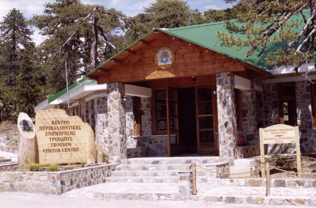
Located close to Plateia Troodous (Troodos Square), the Environmental Centre offers information and an insight on the Troodos National Park; its environmental significance, information on the topography of the mountain range, and the facilities and activities available to visitors at the park.

The centre’s reception area provides information on the geology, flora and fauna of the Troodos mountain range through an exhibition gallery and film theatre, whilst it is also linked to a small botanical and geological trail, where visitors can observe a good sample of various plants and rock formations. The centre also features a small shop.

Region:Troodos area [Lemesos (Limassol) district]
Address:Plateia Troodous, 45km north of Lemesos
Contact No:Tel: +357 25 420 145
Operating Hours:September – May, Monday – Friday: 09:00 – 14:30
June – August, Monday – Friday: 10:00 – 16:00
August 15 (Public Holiday): 10:00 – 16:00
Closed on weekends.
Operating Period:All year round.
Closed on all Public Holidays except for August 15.
Entrance Fee:Adults / children 6+: €1,00.
Website:www.moa.gov.cy/moa/fd/fd.nsf 
 Opening and closing times as well as entrance fees, are subject to alterations without notice. Visitors are advised to check before visiting.

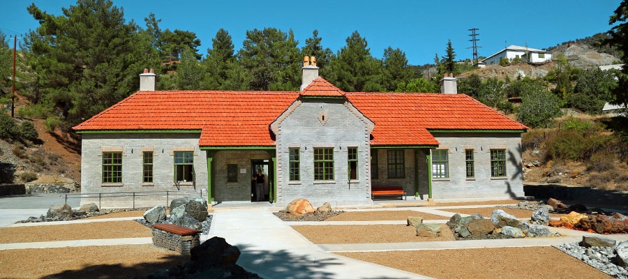
The Troodos Geopark opened in 2015, after 10 years in the making, and will continue to be an ongoing development.

It is located near the abandoned asbestos mine in the Troodos National Forest Park, near the Karvounas – Troodos Road, and next to its sister site of the Troodos Botanic Garden.

The Geopark incorporates an Educational Yard and Viewpoint, as well as a Visitor Centre that presents the Geology of the Troodos mountain range through a variety of interactive and high-tech displays.

In the Exhibit Hall, the geomorphologic rocks of the area are presented, whilst in the Projection Room, video footage shows the emergence of the island from the sea, and the significance of Troodos’ geology. There is also a specialized library.

Region:Troodos area [Lefkosia (Nicosia) district]
Address:Karvounas – Troodos Road
Contact No:Tel: +357 25752401, email: geoparktroodos@gmail.com.
Operating Hours:Tuesday – Saturday: 09:00 – 16:00.
Operating Period:All year round.
Entrance Fee:Adults €3,00 / Children €2,00 (6 – 18), free (under 6).
Special rates for groups of 10 or more persons.
Website:www.troodos-geo.org
 Opening and closing times as well as entrance fees, are subject to alterations without notice. Visitors are advised to check before visiting.

It is often said that a picture speaks a thousand words, but if you’ve ever been down to Agios Sozomenos, you’ll be well aware that seeing the place in real life is even more magnificent – and indeed haunting – than a picture can ever be.

A deserted village just outside Nicosia near Dali, sitting very close to the Green Line, the area evokes an overwhelming feeling of nostalgia and exudes a strange energy of a place left abandoned, encompassed by a sad tale that surrounds the awe inspiring village ruins that now struggle to stand the test of time, set against a backdrop of barren fields and open skies.

Going back into the past, the place is thought to have obtained its name from early Cypriot Saint Sozomenos, an Alaman saint who reputedly lived in a nearby cave in the 12th century A.D.

When it comes to the population of the area, records indicate than in the early 1800s, the village was largely mixed. In 1830, the Turkish Cypriot population was only slightly higher than the Greek Cypriot population. By the end of the 1800s, the Turkish population had increased substantially, and throughout the British period, the Turkish Cypriot population rose steadily, while the number of Greek Cypriots living in the area gradually decreased.

Sources indicate that in 1958, Turkish Cypriots adopted the alternative name ‘Arpalik’ for the village, meaning “place of barley.” By the 1960s, the Greek Cypriots living there amounted to little over 10% of the population.

Its eventual abandonment is sited as being the result of conflict between Greek Cypriots and Turkish Cypriots, with conflict related displacement of both Greek Cypriots and Turkish Cypriots thought to have begun in 1964. Following the events of 1974, most of the Turkish Cypriots living in the area were resettled in Argaki, near the town of Morphou, together with other displaced villagers from nearby areas.

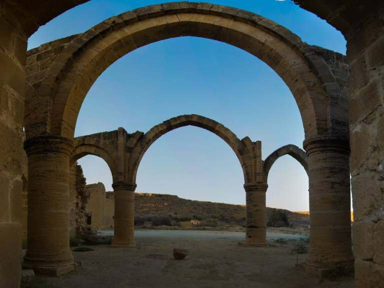
With the houses on site made of mud brick, they have gradually withered away without any upkeep, appearing as though they are far older than what they actually are. One of the most impressive buildings in the vicinity is undoubtedly the ruined 16th century Gothic church of Agios Mamas with its imposing arches, a site which was never in fact finished to begin with. Take some time to admire the building built in retrograde Lusignan style, which is gloriously attractive, despite the fact that only its walls remain.

In the 1980s, Cypriot filmmaker, Panikos Chrysathou, was inspired to make a film about the area named A Detail in Cyprus. In the film, a woman with her small daughter visits the ruined village in the middle of Cyprus flat land. Ex-villagers, Greek Cypriots and Turkish Cypriots come to the ruins, and each of them narrates a personal story of war. The audience in turn is given a glimpse into the trouble of 1964, which transformed the peaceful, mixed village into to a deserted area.

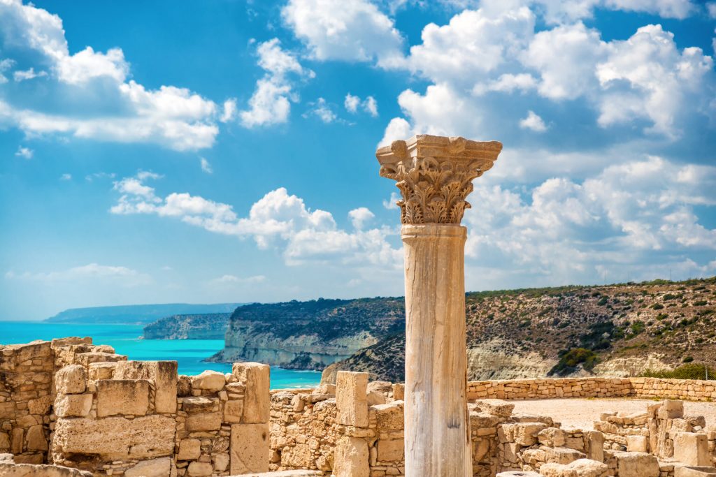
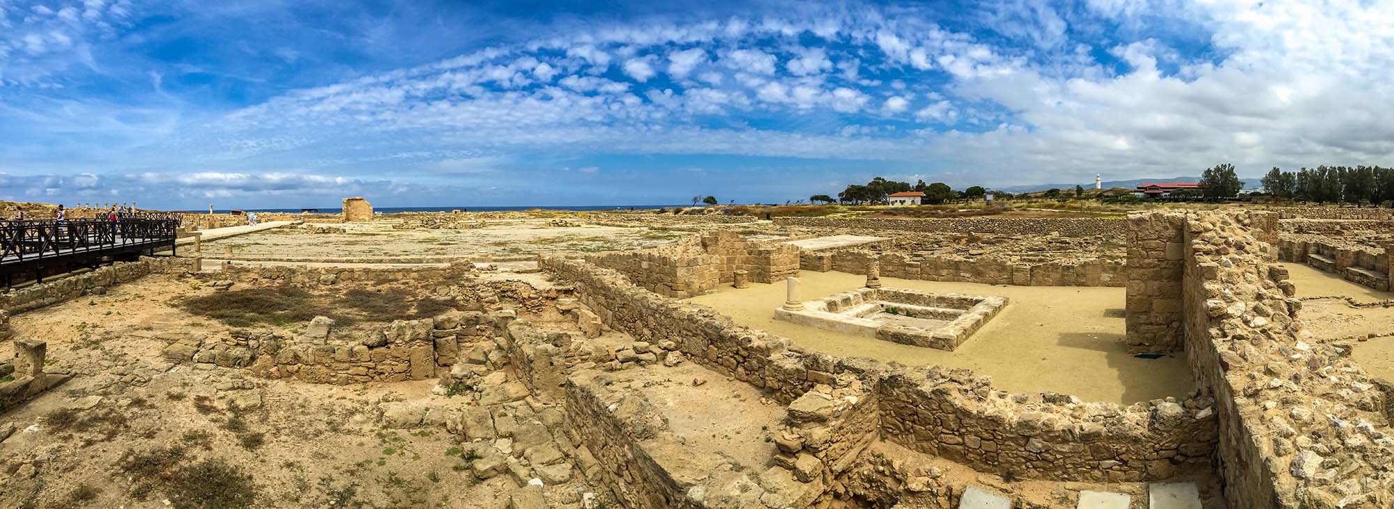
The archaeological remains of Kourion – which was one of the island’s most important city-kingdoms in antiquity – are of the most impressive on the island, and excavations have unearthed many significant finds, which can be viewed at the site.

The city-kingdom was built on the hills of the area, and overlooked and controlled the fertile valley of the river Kouris. According to archaeological finds, evidence suggests that Kourion was associated with the Greek legend of Argos of Peloponnese, and that  its inhabitants believed they were descendents of Argean immigrants. The once-flourishing kingdom was eventually destroyed in a severe earthquake in 365 AD.

The magnificent Greco-Roman theatre – the site’s centrepiece – was built in the 2nd century BC and extended in the 2nd century AD. The theatre has been restored, and is now used for open-air musical and theatrical performances – mainly during the summer months – making it one of the most popular settings for high-calibre cultural events.

East of the theatre are the remains of a prominent building, the ‘House of Eustolios’, which was originally a private villa that was turned into a public recreation centre during the Early Christian period.

Whilst the villa was modest in size, it was well equipped and richly adorned. Its remains consist of four panels of beautiful, 5th century mosaic floors in the central room, and a bathing complex that is located on a higher level, accessed by steps, north of the building. A roof structure allows visitors to enjoy the  site all year round, and explore its remnants.

The baths themselves originally opened off the central room to the north and east, where there were cold baths (frigidarium). Before each is a shallow foot-bath; while on the west, the remains of the hypocausts – which heated the medium room (tepidarium), and the hot room (caldarium) – can be seen. In the latter, the built-in basins for hot baths have survived, as have the firing chambers, where hot air was carried through the hypocausts, travelling up through specially-cut flues, through the walls, and beneath the terracotta tiles of the floor.

Along with the House of Eustolios, there are further impressive mosaic floors in the ‘House of Achilles’ and the ‘House of the Gladiators’, with the villas named after the scenes depicted on the mosaics.

The remains of the Roman Agora are also visible at the site. The structure dates back to the early 3rd century, with additions made later on, during the Early Christian period. The Roman Agora is built on the remains of an earlier public building, which was in use from the end of the 4th century to the end of Hellenistic period.

The Agora of the city is surrounded by porticos with marble columns on both sides, whilst on its northwest side, is an impressive public bath and a small temple, the Nymphaeum, dedicated to the water nymphs.

An early Christian basilica at the site dates back to the 5th century, with separate baptistery on the external northern side.

The Stadium of Kourion  lies 1km to the west, on the right side of the road towards Pafos.

Archaeological Site of Kourion – Audio Guide

Region:Lemesos (Limassol)
Address:Kourion, 19km west of Lemesos on the road towards Pafos (Paphos)
Contact No:Tel: +357 25 934 250
Operating Hours:September 16 – April 15, daily: 08.30 – 17:00
April 16 – September 15, daily: 08:30 – 19:30
Operating Period:All year round.
Closed on Christmas Day, New Year’s Day and Easter Sunday (Greek Orthodox).
Entrance Fee:€4,50
For organised groups consisting of more than 10 persons there is a 20% reduction on the entry fees.
The Department of Antiquities can issue special entry cards for all its museums and ancient monuments: One (1) day entry cards – €8,50, three (3) day entry cards – €17,00, seven (7) day entry cards – €25,00.
Disabled Access:Partly accessible.
Website:www.mcw.gov.cy/da
 Opening and closing times as well as entrance fees, are subject to alterations without notice. Visitors are advised to check before visiting.


Located on the slopes of Kionia, in the valley of Machairas mountains, Machairas Monastery is one of the three Royal and Stavropegic of the island and houses the miraculous icon of Panagia (the Virgin Mary) of Machairas, which is attributed to Agios Loukas (Apostle Luke) the Evangelist.

According to tradition, an unknown hermit sneaked the icon into Cyprus during the iconoclasm years (between the 8th and 9th century AD) and kept it in his cave until his death. Blessed with the divine grace, the hermits Ignatios and Neophytos around 1145, discovered the cave – which was obscured by bushes – and were able to reach it by cutting down the undergrowth with a knife given to them by divine hand. As a result, the revealed icon was given the name  ‘Machairiotissa’ from the Greek word for ‘knife’ – ‘machairi’. The monastery was built on the same spot, also taking the name.

Today, the renovated vestry basement houses a collection of old books and manuscripts, icons and other religious artefacts.

The brotherhood at the monastery is extremely devout, keeping vows as strict as those of Mount Athos in Greece.

Monastery of Panagia tou Machaira – Audio Guide 

Region:Troodos area [Lefkosia (Nicosia) district]
Address:Machairas Valley
GPS coordinates:Lat: 34.940564 Lon: 33.189247
Contact No:Tel: +357 22 359 334, Fax: +357 22 359 333
Operating Hours:
Daily: 9:30 – 18:00
Saturday-Sunday: 6:30 – 18:00
From July to the end of  October, the old building of the Monastery remains closed for pilgrims, who may visit the Church of Agios Gregorios Palamas by the entrance of the Monastery.
Visiting hours for organised tourist groups: Monday,  Tuesday, Thursday 9:00-12:00, following previous communication.
Operating Period:All year round. 
Entrance Fee:Free
No photography or video permitted.
 Opening and closing times are subject to alterations without notice. Visitors are advised to check before visiting.


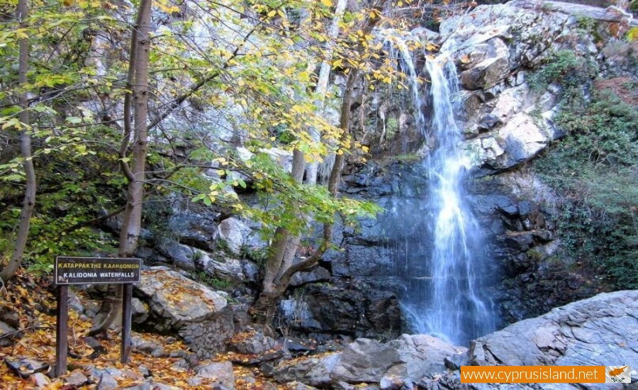
Caledonia Waterfalls are located in Platres village in Troodos. This beautiful waterfall is one of the highest located in Cyprus and is surrounded by forest and it is most popular in summer, when it offers a cool and shady retreat from the powerful midday sun.

The trail has a length of 3 km and can be divided into 2 parts, the higher one that leads to the waterfalls, and the lower one, from the waterfalls to Platres. The route might be difficult due to the sudden changes in gradient, but it is quite easy with decent shoes. The route is suitable for adults in good fitness levels. Unsuitable for very young children. If you do not wish to take the long nature walk path there is an easy access by foot straight to the main waterfall (about 20 minutes walk) from Aedonion road, by the trout farm in Pano Platres.

On the route you will observe many species of the local flora. Relax and enjoy the natural sound of the wind on the tree leaves and the sweet bird singing. It is worth noting that the name Caledonia Falls originates from the swallow birds singing during spring and summer evenings.

Walking time: 1,50 – 2,00 hours


Built during the Venetian rule (1489-1571) a series of hidden bridges are dotted around the villages of Cyprus. The bridges formed part of the old camel trail, built by the Venetians to extract anything valuable they found on the island, such copper from Pera Paidi village. Make a fun day-trip out of exploring them and go for a walk on the Venetian Bridges nature trail opened by the Department of Forests or a 4 x 4 drive.

Nestled amongst vegetation and built over streams, there’s usually a cool climate surrounding the bridges which is an ideal break during the hot months and an enjoyable excursion in autumn and winter. With various Venetian bridges scattered around, here are three you shouldn’t miss out on.

Tzelefos bridge, Paphos district

Definitely the most known bridge of the island, you’ll find it in Paphos’ forest and it can easily be accessed from Limassol and Troodos as well, with all routes offering beautiful views of cypress and pine trees. Its popularity is due to the fact that that it’s the largest stone bridge ever build in Cyprus and goes over river Diarizos. Found in an area of rich green vegetation, the forest area engulfing it is beautiful and has various nature spots to be explored. Many hikers, tourists and even newly-weds make a stop to be photographed with the charming Tzelefos bridge. Only 6km from Ayios Nikolaos villages, enrich your journey by visiting some other nearby picturesque villages such as Omodos, Arsos and Vasa.

Elia Bridge, Paphos/Limassol district

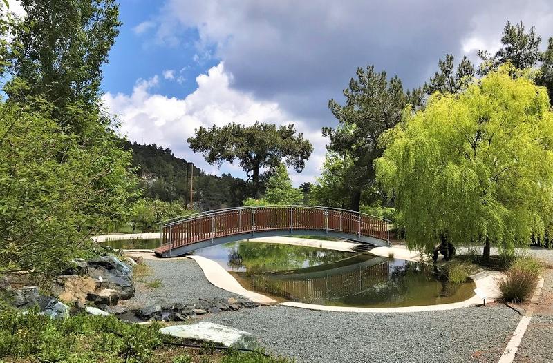
Very near Kaminaria village (4km) and only 2km from Tzelefou bridge, Elia bridge is built where the river of Kaminaria and Diarizos meet. The name of the bridge translates to “olive” and as the name suggests there was a vast reach of olive trees in the area. Look out for the carving of crosses on both sites of the bridge, considered to be its main characteristics. To experience its vegetation bloom, visit over winter or spring when the river will most likely be running and more green will be decorating the area.

Akapnou Bridge, Limassol district

A lesser known Venetian bridge, even for locals, is that of Akapnou and surprisingly features two arches rather than the typical Venetian style of one. 25 minutes from Limassol, finding it might be a tricky task as it’s buried in wilderness at the end of a dirt road. Whilst on the Akapnou – Eptagonia road, pass by Akapnou village, cross the modern bridge and look for a sign for the Venetian medieval bridge on the right. This will lead onto the dirt road. If with a rental car and worried about taking it down a bumpy road, park and walk around 300 meters to get to the bridge. Approaching you have a wonderful view of the two arches, just be careful of the wild vegetation growing free around it and any sharp drops.

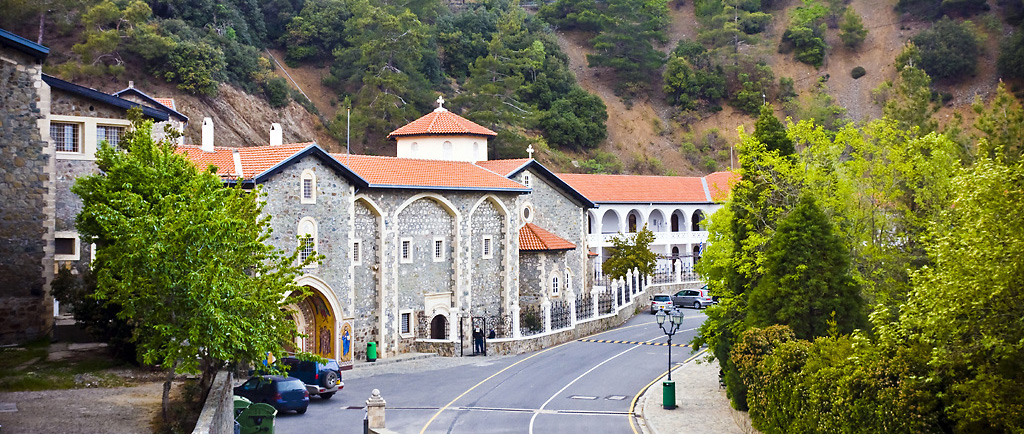
Located in the mountainous region of Marathasa Valley, the Monastery of Kykkos is the wealthiest and most lavish on the island, and stands on a mountain peak, at an altitude of 1.318 metres.

Dedicated to Panagia (the Virgin Mary), the monastery possesses one of three icons attributed to Agios Loukas (Apostle Luke) the Evangelist. The icon – covered in silver gilt – is in a shrine made of tortoiseshell and mother-of-pearl that stands in front of the iconostasis.

According to tradition, Cypriot hermit Isaiah miraculously healed the daughter of Emperor Alexios I Komnenos (1081-1118 AD). As a reward, he asked for the icon, and though grieved at the prospect of losing the treasure, the emperor sent it to Cyprus, along with the funds to pay for the construction of a monastery where the sacred relic would be kept. The monastery burned down several times and nothing remains of the original structure.

Today, the monastery produces Zivania spirit and other alcoholic drinks, and holds religious fairs on September 8th (Birth of the Virgin) and August 15th (Dormition of the Virgin). There is also a museum on the grounds, whilst it is noteworthy for being the monastery that the first President of Cyprus, Archbishop Makarios III served at as a novice.

Monastery of Kykkos – Audio Guide 

Region:Troodos area [Lefkosia (Nicosia) district]
Address:Marathasa Valley, 13km from Pedoulas village
GPS coordinates:Lat: 34.98334 Lon: 32.741299
Contact No:Tel: +357 22 942 742,  Fax: +357 22 942 384
Operating Hours:November – May: 10:00 – 16:00
June – October: 10:00 – 18:00
Operating Period:All year round.
Closed on Public Holidays.
Entrance Fee:€5,00 / Groups €3,00
Website:www.kykkos.org.cy
 Opening and closing times as well as entrance fees, are subject to alterations without notice. Visitors are advised to check before visiting.


The name of Mitsero:
There are several versions on how the village got its name. According to one of them, its name is due to the tax code of the Great Commandaria, which had the Knights Templar in 1100 AD. which they called Micero.
Another version reports that its name was taken from the plants found in the area which are called “matsikorida” (maquisarius).
On old maps the village is marked as Micco.

The population of Mitsero:
According to the census made by the British Government in 1881, the village had a steady population increase. In the period 1931 – 1946 the inhabitants grew more because the gold factory was created and several residents found work there and did not leave the village. In 1952, when mines began operating, the population grew and almost doubled.

According to the 1992 census, the population of Mitsero was 684 inhabitants.

The crops of the village:
In Mitsero, besides the Adelphi forest and the adjacent private forest, there are no other tree-lined areas inside or outside the village. Mitsero is not famous for its fertile fields, however, cultivated on a limited area of barley, wheat, sunflowers, citrus fruits, various fruit trees, few vegetables and legumes (beans). There are also greenhouses where flowers are grown. It is worth noting that the latter began the systematic cultivation of medicinal and aromatic plants from a factory of natural cosmetics. In the entire area of Mitsero there are various greens and mushrooms. The Mitsero Flora contains almost all the flowers, herbs and shrubs that we find in Cyprus.

In Mitsero there are all kinds of soil. Reddish, white and mixed soils. It is rich in minerals (gold, copper, pyrite).

The church and mine of Mitsero:
The church of the village is dedicated to the Archangel Michael, it is a one-aisled church with three apses. The roof is made of wide tile.

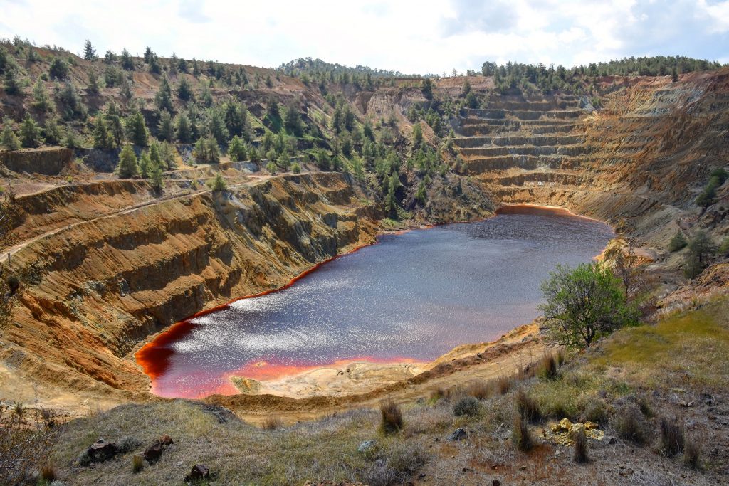
Also, in the village of Mitsero, you will find the Kokkinopezoulas mine, the Kokkinogias mine and the red lake. In the 1950s, after excavations of the Hellenic Mining Company, iron ore deposits were found in the Kokkinopezoulas area in Mitsero. The Kokkinopezoulas mine ceased to operate in 1967. Explosions made to locate ores left many injured, and many lost their lives. The mines gave bread to the inhabitants of the surrounding villages for decades, but at the same time was the cause of most of the deaths in the villages.

The destruction of the area was great that it was no longer possible to survive. The birds, animals and trees around the lake began to die. The water of the lake had been colored red by the minerals and its high acidity. In recent years nature began to heal its wounds and show signs of life in the Lake District. Today, it is a pole of attraction for many tourists, foreigners and natives, since it presents a unique phenomenon. It is rare to find a Red lake.
The name of Mitsero:
There are several versions on how the village got its name. According to one of them, its name is due to the tax code of the Great Commandaria, which had the Knights Templar in 1100 AD. which they called Micero.
Another version reports that its name was taken from the plants found in the area which are called “matsikorida” (maquisarius).
On old maps the village is marked as Micco.

The population of Mitsero:
According to the census made by the British Government in 1881, the village had a steady population increase. In the period 1931 – 1946 the inhabitants grew more because the gold factory was created and several residents found work there and did not leave the village. In 1952, when mines began operating, the population grew and almost doubled.

According to the 1992 census, the population of Mitsero was 684 inhabitants.

The crops of the village:
In Mitsero, besides the Adelphi forest and the adjacent private forest, there are no other tree-lined areas inside or outside the village. Mitsero is not famous for its fertile fields, however, cultivated on a limited area of barley, wheat, sunflowers, citrus fruits, various fruit trees, few vegetables and legumes (beans). There are also greenhouses where flowers are grown. It is worth noting that the latter began the systematic cultivation of medicinal and aromatic plants from a factory of natural cosmetics. In the entire area of Mitsero there are various greens and mushrooms. The Mitsero Flora contains almost all the flowers, herbs and shrubs that we find in Cyprus.

In Mitsero there are all kinds of soil. Reddish, white and mixed soils. It is rich in minerals (gold, copper, pyrite).

The church and mine of Mitsero:
The church of the village is dedicated to the Archangel Michael, it is a one-aisled church with three apses. The roof is made of wide tile.

Also, in the village of Mitsero, you will find the Kokkinopezoulas mine, the Kokkinogias mine and the red lake. In the 1950s, after excavations of the Hellenic Mining Company, iron ore deposits were found in the Kokkinopezoulas area in Mitsero. The Kokkinopezoulas mine ceased to operate in 1967. Explosions made to locate ores left many injured, and many lost their lives. The mines gave bread to the inhabitants of the surrounding villages for decades, but at the same time was the cause of most of the deaths in the villages.

The destruction of the area was great that it was no longer possible to survive. The birds, animals and trees around the lake began to die. The water of the lake had been coloured red by the minerals and its high acidity. In recent years nature began to heal its wounds and show signs of life in the Lake District. Today, it is a pole of attraction for many tourists, foreigners and natives, since it presents a unique phenomenon. It is rare to find a Red lake.
 

Underneath an old fig tree, shaded from the warm Cyprus sun, is a small natural grotto. Water flows down a wall of rock and forms a pool amongst the moss. It is here that legend says Aphrodite would come to bathe. According to Greek mythology, she met her lover Adonis at the pool when he stopped for a drink while hunting.

The pool is quiet and cool – a pleasant place to relax – but it’s just a small part of what’s on offer here. Although the name ‘Baths of Aphrodite’ at this location may have been influenced by this grotto, it actually applies to a larger natural area here at the coast of the Akamas Peninsula.

Entering the Akamas Natural Reserve Park from the car park to the grotto, you’ll pass through a botanical garden that has most of the perennial indigenous plants of the region. Specialised guided tours can be arranged, which are suitable for the whole family.

From the baths, a 2.5km (1.5 miles) trail to the West follows the legendary path that the Goddess of Love would take to rest under a large oak tree after her bath. From here, the path splits into two hiking routes called ‘Aphrodite’ and ‘Adonis’. Both trails are about 5km (3 miles) long and should take you about two hours to walk.

As well as seeing the diverse plants and animals of the Akamas Park, there are significant geological formations in the area. The walking trail along the coastline has magnificent views out over the sea. There are also swimming spots at some of the nearby beaches, with the opportunity to relax.

The ‘Baths of Aphrodite’ is about an hour’s drive from the Pafos harbour. There is a parking lot, shops and a restaurant at the site. Also, the nearby Local Archaeological Museum of Marion-Arsinoe at Polis Chrysochous has some ancient artifacts that are part of the Route of Aphrodite and is worth stopping at while in the area.


This 700-year-old Cyprus castle is the birthplace of the world’s oldest wine, said to be toasted by Richard the Lionheart at his wedding.  

IN 1191, RICHARD THE LIONHEART celebrated his conquest of Cyprus by wedding a Spanish princess at Limassol Castle, ordering barrels of wines from the nearby village of Kolossi for the nuptials. The crusading King of England toasted the lavish ceremony with a swig of the sweet nectar and, legend has it, declared the drink “the wine of kings and king of wines.”

Commandaria, as the wine was called, still exists today, making it the world’s oldest manufactured wine. The dessert wine derives its name from “La Grande Commanderie,” the military headquarters of the Knights Templar and Knights Hospitallers, two famed knightly orders that occupied Cyprus for hundreds of years during the Crusades from their base at Kolossi Castle, built in 1210.

It could be expected that a castle home to such romantic stories of chivalric knights and wine fit for kings would exhibit an equally fantastical appearance. But in fact the image of fairytale European castles arose around the 1500s; Kolossi Castle predates these iconic structures by at least two centuries. Castles were originally built for military strategy, but after gunpowder came into prominence wealthy aristocrats built them as symbols of prestige and fantasy, crafting a starry-eyed view of the life of kings and queens from centuries past. In contrast, Kolossi Castle comes from a time of practical defense. It wasn’t built for style; it was built for war.

The stronghold’s tower allowed for an unobstructed view of the countryside and its symmetrical structure provided broader sight-lines for detecting enemy armies. The knightly orders that built it were steadfast in their martial duties, prioritizing military strategy, not architectural beauty. This focus on security and defense was necessary in Cyprus to deter attempted enemy conquests, which it was burdened by for more than a millennium. Its strategic location in the Mediterranean meant that almost every empire sought to control it: the ancient Greeks, the Romans, the Byzantines, the Ottomans. Visiting Kolossi Castle today is about more than gazing at architectural beauty; it’s about standing in the footsteps of centuries of history.

Located just past the western edge of Ayia Napa is Potamos Liopetri, or Liopetri River. This small fishing enclave boasts some idyllic scenery and is a peaceful and relaxing area.

Fishing here has pretty much gone unchanged for decades and the river is home to an eclectic mix of traditional and modern fishing vessels. A small sand and rocky beach and 2 excellent fish restaurants make this area well worth a visit. In springtime the surrounding countryside is abundant with wildflowers and it is easy to forget that the hustle and bustle of the centre of Ayia Napa is just a few miles away.

Potamos restaurant is a family business established in 1960. It is located in a beautiful area next to the sea coast and fishermen boats where you can enjoy fresh fish and amazing views.

The owners do their best in order to provide their clients with the best quality dishes made of freshest local ingredients along with amazing ambience. Besides a wide range of starters, menu includes fresh fish, seafood and a variety of dips, fresh vegetables and salads made with passion and served.